
Unsure Which Product?
Unsure which package you need? A product comparison:
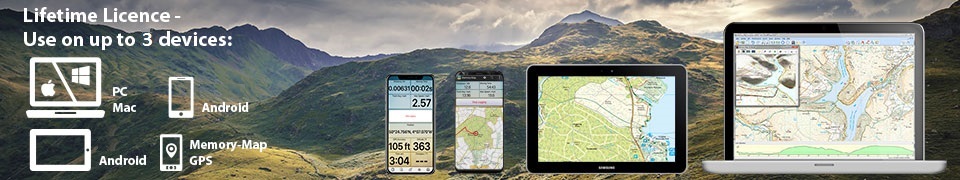
PLEASE NOTE All single and multiple software packages are supplied with a single user licence (see Terms and Conditions) for use on a PC/laptop and are GPS compatible.
LinesMan The Somme and Ypres Products
These two USB products have been produced for those whose interest is limited to these two specific areas and include over 100 British Trench Maps in 1:10,000 scale and a 1:100,000 scale modern road map which are GPS compatible, but do not support 3D terrain analysis functions
LinesMan Western Front 1915-1918 1:10,000 or 1:20,000 Products
These products are complementary and in combination provide complete coverage of the British sectors of the Western Front from 1915 to 1918. When loaded together they link seamlessly and complete the largest collection of British mapping of the First World War published since the Great War itself.
If contemplating the purchase of LinesMan for the first time and you do not wish to buy both products immediately, you may wish to consider the following:
| LinesMan Western Front 1915-1918 1:10,000 | LinesMan Western Front 1915-1918 1:20,000 | |
| 1:10,000 scale trench maps | 1:20,000 & 1:40,000 scale maps | |
|
Other historical maps of various scales Extensive modern mapping with height data to support 3D terrain analysis functions |
Wider coverage across sectors of the Western Front. Areas covered include back areas and some advanced areas in preparation for potential fighting. In particular, these maps cover the areas of mobile warfare conducted during the final months of the war in 1918 | |
| Area covered (Map Key) | Area covered (Map Key) | |
| Nieuport to St Gobain (N to S) Coxyde to Ursel (W to E) |
Flushing to Berry-au-Bec (N toS) Sangatte to Sedan (W to E) |
|
| Date range 1915 to September 1918 | Date range 1915 to November 1918 | |
| Large scale conducive to good GPS accuracy | Smaller scale maps likely to be less accurate than 1:10,000 scale maps when used with GPS | |
| Ideal for: | Ideal for: |
|
| Battlefield exploration on foot with GPS | General battlefield touring with GPS | |
| Research and study on PC/laptop, particularly helpful interpreting unit war diaries and other detail historical accounts | Research and study on PC/laptop, useful as an aid in the understanding of historical accounts |
Licensed for private and non-commercial use only
Maps: These can be copied to a PC/laptop (recommended) or be used from USB.
PC: Microsoft Windows 10, 8, 7. Internet connection required for product registration.
MAC: Apple Mac OS. Internet connection required for product registration. Important Note: The maps are currently NOT compatible with Apple iOS (iPhone/iPad)
Mobile: Android smartphone/tablet. Apps available separately.
GPS: Memory-Map Adventurer, Garmin, Satmap, Lowrance, Magellan, Suunto or GPX/NMEA/SIRF compatible. Some GPS units do not support all map, mark, route, track, HRM, elevation and other features - check with your GPS supplier
Examples of LinesMan in action - Image 1: The PC view of comparing the modern day base map of the Western Front to the LinesMan Map Index, illustrating coverage.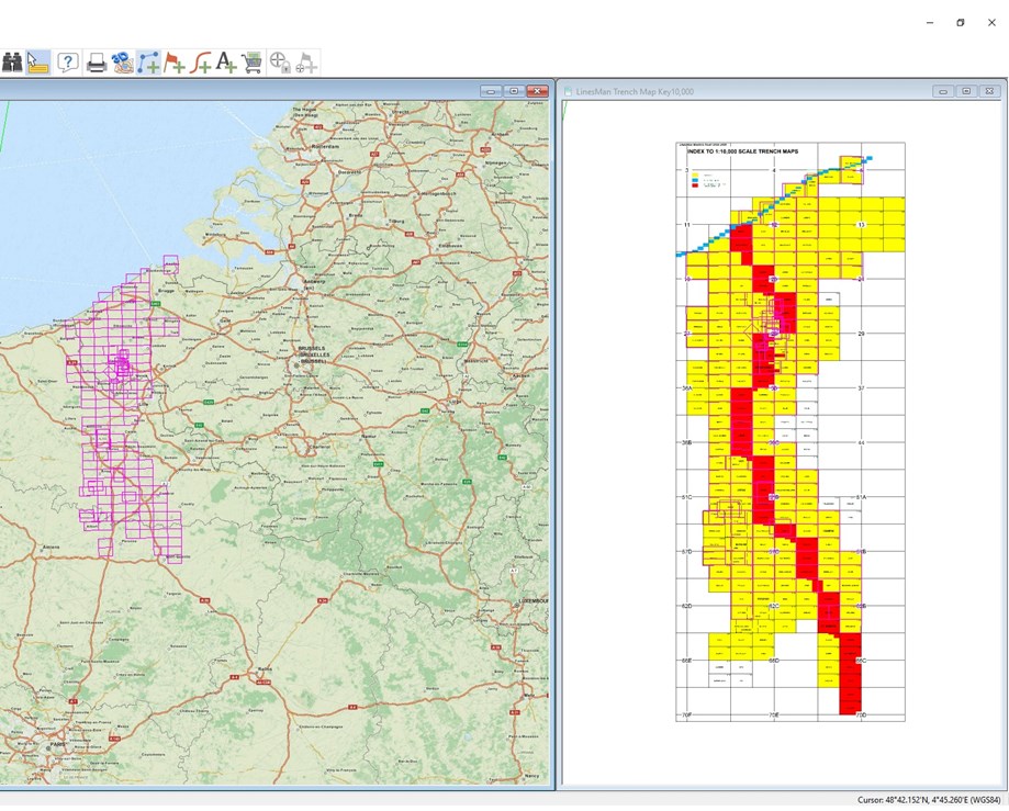
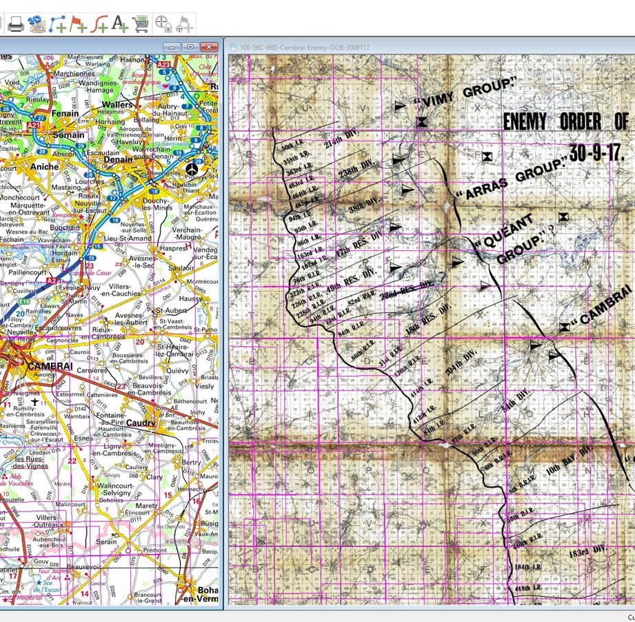
LinesMan in action - Image 2: The PC view of comparing the modern day IGN map of Cambrai with one of the LinesMan maps for 1917.
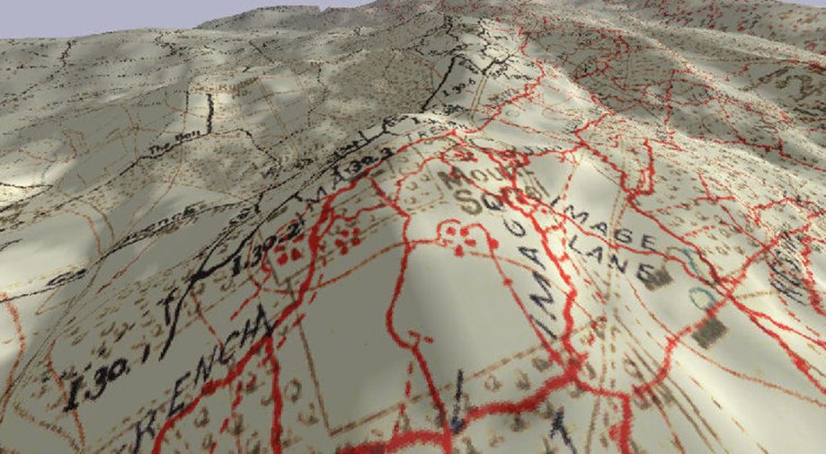
LinesMan in action - Image 3: A view of Mount Sorrell in 3D (please note 3D only works on a PC with the LinesMan Western Front 1915-18 1:10,000 map Set).

PC/Mac and Mobile software powered by