
The Project
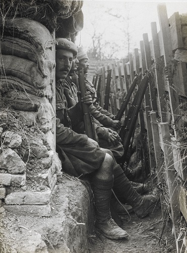
Great War Digital have sought to bring you the most complete archive possible of the trench maps printed by the British Army Royal Engineers during the Great War of 1914-1918. The four years of relatively static warfare, entailed the excavation of thousands of miles of trenches and static fortifications.
In the intervening 100 years, much of this legacy has been filled in by man, and reclaimed by nature, and has disappeared from view into the rolling fields of France and Belgium.
All that remains to locate the places where our ancestors fought and died, are the trench maps.
These maps are now few and far between. They reside in our national institutions, such as The National Archives, the Imperial War Museum, and the Royal Geographical Society, and in smaller numbers in private collections and museums throughout the world.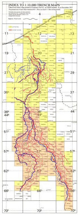
Great War Digital have searched these institutions, and visited numerous private collections over four years, to scan a selection of over 800 maps in 1:10,000 scale.
Over a further two years we were ready to release a follow up 1:20,000 scale product that has over 1,000 maps in 1:20,000 and 1:40,000 scale. Together this has made available nearly 2,000 British Trench Maps of the Western Front.
The scope of the trenches covered, on the 1:10,000 scale product is shown in the scale TrenchMap Key with 'Vector' trench overlay to the right, covering an area of the British sector of the front, from Zeebrugge in Belgium, down to St Gobain in France. (The 1:20,000 scale version reaches the northern outskirts of Reims, so covers a much wider area). The dates covered range from 1915 and the Battle of Loos, to the last days of the war in 1918.
Each map is included in as many editions, for as many dates of correction that it has been possible to find. The right click 'Maps at Cursor' feature produces a list of all editions at that location from which to choose. The above key gives an idea of numbers for overall coverage in 1:10,000 scale, but each square has many maps available to view within it.
In addition, for the first time ever, because these maps are now 'geo-referenced' into real world co-ordinates, it has been possible to enable the maps to be displayed in an up to date IGN Satellite Navigation platform. It is therefore now possible to swap the views between modern maps and The Great War. The vector trench overlay shown over the 1:10,000 map key remains to be viewed over the IGN 1:25,000 or modern IGN aerial photography. The vector overlay has been created by us as a direct copied overlay of each trench map that we have in the system. It includes all major front line trenches, and significant reserve trenches.
All the major trenches have been vectorised (electronic lines). Any Trench Map that shows a section of front line trench with No-Mans-Land in between, has been copied with a thick blue line for British, and a thick red line for German. In addition, any significant lines of support have been copied using a thinner line. The purpose is to allow the overlays to be viewed over the modern IGN, or aerial photography, and to help you familiarise yourself with the main battle locations.
The set of 10,000 and 20,000 vector lines shown above, can be turned on and off independently. (see our Getting Started page for basic instructions)
BUY LINESMAN NOW at prices from £39.95