LinesMan Mapping
Trench Maps of the Great War - at the touch of a button!
LinesMan is PC based innovative software presenting historical map data on a modern digital platform.

LinesMan provides easy access to all trench maps. All maps are geo-referenced which permits simple navigation between maps on screen without the need to refer back to a map index.
LinesMan functions on your PC as a versatile trench map viewing medium, providing many features to enhance your study and understanding of the Great War in the comfort of your own surroundings.
View our products page for more information
For the WW1 battlefield explorer LinesMan can be used with a suitable hand held GPS device.

An on-screen marker will show your real-time position on the trench map of your choice. This functions with trench maps, modern maps and aerial photographs as are available across the range of LinesMan/Memory-Map products.
Find out more on our GPS/mobile page or see our preloaded tablet option LinesMan2Go
Mapping from The Great War to Modern
Linesman Western Front 1915-1918 USB provides access to historical and modern mapping and also includes height data for 3D terrain modelling and track elevation functions.
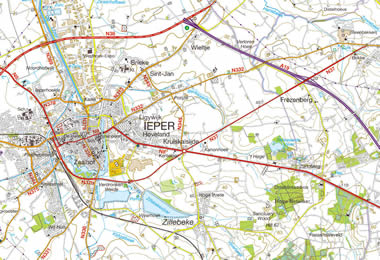
In addition to 1:10,000 scale trench maps and other historical maps of various scales, four further scales of Europe road mapping for navigation are provided:
3D Trench Maps - unique to LinesMan
Using the 3D function button in the toolbar a trench map is instantly transformed to a terrain model  The image can be spun and flown through by manipulating the mouse controls. This enables the view to be positioned as required. This same feature can be applied to all maps supplied within the product. Note: This advanced feature is not available for LinesMan Western Front 1:20,000, LinesMan The Somme or LinesMan Ypres unless used in conjunction with LinesMan Western Front 1915-1918. Please also note that the iOS version of the Memory-Map App does not support 3D.
| IGN 1:25,000 |   |
| NGI 1:50,000 |  |
| IGN 1:250,000 |  |
| IGN 1:1,000,000 |  |

PC/Mac and Mobile software powered by


